Loading...
YEGUAS HILL AREA
In the Yeguas hill, which is located in the southern sector of the mining district of Andacollo, 6.5 km to the south-east of the homonymous town, a group of gold veins incipiently explored and exploited can be found. One of them is called "Desconfianza", mine owned by Minera Cordillera del Viento S.A.
There are also other important mines in the area such as Helena, El Porvenir, 17 de Octubre, La Victoria, Martha Ester, Salamanca and the veins of Yeguas Hill; among all of them, the mine Helena has been the most exploited one and is the best known.
Mine Helena
This mine is situated in the south-west slope of Yeguas hill, in the confluence of the streams Atreuquito and Milla Michicó. There, three veins of lentiform habits can be found, fitted in volcanic rocks of the formation La Premia. (Llambías et al, 2007). They present directions ranging between N 74° and 66° E and inclinations of 70° to 7° to S. The strike reaches 300 meters and the power of the veins varies from 0.30 to 0.70 meters.
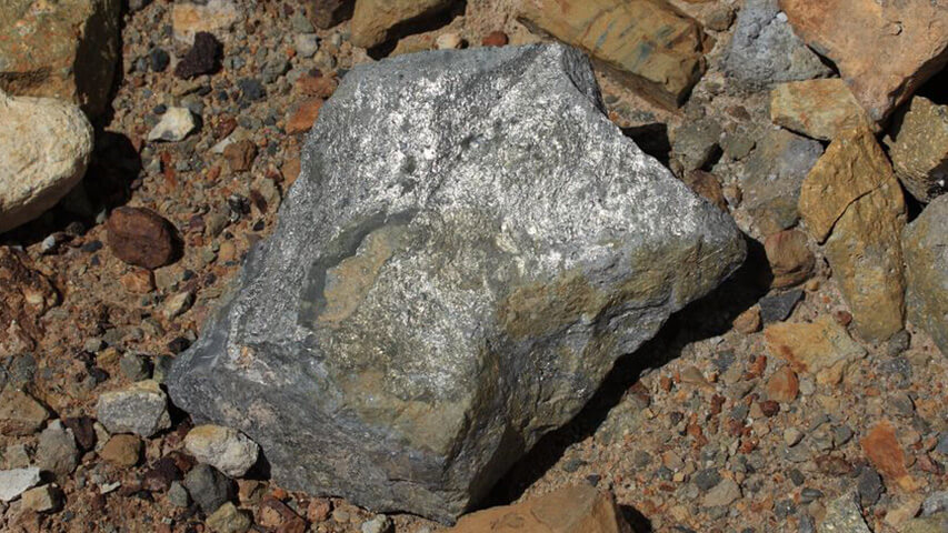
The mineralization is made up of galena, sphalerite, gold pyrite and chalcopyrite in quartz veinstone, with limonite, malachite and azurite among the oxidation minerals.
Chemical tests made on three mineralization representative samples showed the following results: Pb: 3,3-47,7% - Zn 5,5-30,5%; Cu: 0,7-1,80%, Au: 2-4,5 g/t ; Ag 100-300 g/t. 75 meters of drifts were made in the mine Helena. (Rovere et al, 2004).
Mine Desconfianza
Located immediately to the north of the vein Helena, it includes 6 properties of 6 hectares each one. Two of them are placed adjacent and parallel to the vein Helena, while the remaining ones are located in the direction N-S at 90° in relation to the first ones. The disposition of the properties East-West cover the main structure of the vein whereas those North-South cover less developed fractures of general course NE-SW. The veins are placed in the same wall than those in the environment, and just like its neighbors, the mineralization is represented by filling of gold pyrite, associated with galena and sphalerite, in quartz veinstone with abundant limonite. The mining works consist in a drift or main entry of about 25 / 30 meters (currently flooded) along the vein E-W, sub-vertical and with power ranging from 0,35 to 0,70 m. Trenches and cuts along veins that run in diagonal to the main one show occasionally some guides of quartz with pyrite of poor development and thickness.
Vein Salamanca
Placed in volcanic rocks of the same geological entity, mainly consisting in rhyolite and compact volcanic tuffs with dacitic to rhyolitic composition and minor proportion of andesitic terms. This site contains sub-parallel quartz veins of 0.40 to 0.60 m. of power, as filling of gravitational fractures of strong dip. Gold is associated to quartz in oxidation areas and to pyrite and chalcopyrite in primary mineral areas. The gold content varies from 4 to 8 grams per ton.
Veins of Yeguas HillA group of gold pyrite veins is located in the slope E and SE of the Yeguas Hill with power of more than 1 meter in some cases and strikes of 200 to 300 meters or even more. This is the case of the vein called "Quebrada" which can be followed with some interruptions along 350 meters; its direction is N 80° E with an inclination of between 75° to 80° to the north. The mining works consist in several superficial openings done in oxidation areas and a couple of poorly developed drifts where the pyric filling is exposed. Together with the vein "Quebrada I" sub-parallel to the previous one, they were partially exploited obtaining a mineral with an average content of gold of 10 g/t (Stoll, 1957). A third vein called "Reina" is located in the lower slope of the hill approximately 300 meters south from the previously mentioned veins; its direction is also E-W, also inclined with strong dip to the north and its power rarely surpasses 0.30 m.
The vein called "Colorada" can be found in the southern part of the area. Its surface is rich in limonite and hematite, which explains its name. A sample of 1.20 meters gave a trial of 2 g/t. (Stoll, 1957). At the end of the drift, which is no longer than 25 meters, the vein reaches only 30 cm wide, containing plenty pyrite in clay filling. A sample of this part showed 10 g/t. Au.
Veins of the string Milla MichicóStoll(1957) mentioned a group of minor veins located at both sides of the string called Milla Michicó, downstream of its confluence with the stream Atreuquito. A four parallel vein system can be found there: the vein “Milla Michicó&rdquo to the north of the homonymous string and veins "Don Pedro", "Salas" and "Schmidt" on the south bank. In general, they are veins of quartz with pyrite, galena and some sphalerite with direction N 70° E with power of 0,20 to 0,80 meters and grades ranging between 4 and 15 g/t Au.
Petrographic and geochemical characterization researches of rocks found in the southern area of the district Andacollo performed by Giusiano (1988) and Casé et al (1998) enabled to determine the dominant hydrothermal alteration pattern as well as the background and geochemical thresholds of gold and silver.
The previously mentioned studies show that the rocks of this area present incipient to moderate alterations even if it is phyllic with sericite and quartz as if it is potasic with secondary biotite formation of fine grain and sericite, and in the clayey minerals of the group of montmorillonite.
From the geochemical point of view, the sampling allowed to recognize two sample populations: one including rocks with gold content between 0.02 and 0.06 ppm and another one with values reaching 0.2 ppm. In relation to the Ag cation the frequency distribution curves also showed two populations between 0.20 and 0.40 ppm. With respect to the areal behavior of such parameters, there is a larger uniformity in the bottom values in comparison to the erratic trend of the geochemical threshold that shows notorious modifications nearby mineralized vein structures. The values of geochemical bottom are around 0.3 ppm while those correspondent to silver are between 0.3 and 0.4 ppm. The threshold of geochemical anomalies has been set between 0.06 and 0.07 ppm for gold and from 0.5 to 0.6 ppm in case of silver. This values have an important prospective meaning since they can be taken as a reference for the evaluation of the results of the sampling done by Danderfer (2006) nearby the veins of the area or in case of further geochemical rock sampling in the area.
According to the structural properties of the vein called "Desconfianza", and to descriptions of the rest of manifestations and veins in the immediate environment, this area includes in general structures of limited development, of lentiform habit with variable thicknesses, occasionally exceeding one meter. As described by Danderfer (2006) "...the mineralization at first sight is narrow and discontinuous". This characteristic is a condition that would limit by itself the possibilities to develop a mine in each of the structures.
However, the fact that the mineralization is of polymetallic character adds more metallogenic interest to the surrounding area, especially considering that some explorations done by Placer Dome in the west side of Yegua Hill showed that a disseminated mineralization was found only 2 km away from these veins. Apparently, those disseminations are related to medium-volume sub-volcanic intrusives, which would equally condition the mineralized areal development. The veins of the sector, restricted to small structures, would constitute the superficial expression of such disseminations, together with hydrothermal alterations in the rocks of the area and the geochemical anomalies detected.Since andesitic veins/sills were recognized nearby the properties in vein "Desconfianza", the suggestion to carry out a detailed mapping and eventually exploration drillings aims to define in the area around the mines in this sector the presence of dissemination similar to the dissemination found in neighbor areas. This hypothesis could define "by means of the suggested works" the future of the mining properties of "Desconfianza" and the adjacent mines.
Indeed, taking into account that the economic limits of most deposits of this kind are defined in an area of between 1 and 1.5 km², and sometimes less, the suggested exploration should be done within the property of the existing mines. The goal would be to find in the mines the most appropriate sites to locate at least two explorations that would allow investigating the subsoil within the legal covering granted to the mines of the area, which properties reach together an approximated surface of 0.5 km². The results of the geological mapping and detail sampling will show the most convenient location to execute the drillings.
Location of the mine Desconfianza and adjacent ones in the southern slope of Yeguas Hill.
Casé , A.M., Giusiano A. and Schalamuck, I. 1998- Geology and geochemical of Au and Ag of the group Choiyoi, west side of Cordillera del Viento. Neuquén. Argentina. IV Encounter of Mineralogy and Metallogeny. National University of the South, Bahía Blanca. MINMET 98 EDIUNS : 33-41-
Danderfer J.C., 2006. Minera Cordillera del Viento S.A. Geological summary of the mining properties studied in December 2005- May 2006. (unpublished)
Giusiano, A 1988-. Geochemical prospection of Cordillera del Viento- First stage. Final report General Mining Department - Neuquén . Zapala
Llambías, E.J,, Leanza, H.A. and Carbone, O., 2007. Tectono-magmatic evolution during the Permian to the early Jurassic period in Cordillera del Viento (37º05’S - 37º15’S): New geological and geochemical evidences of the beginning of Neuquén’s basin. Magazine issued by the Argentine Geological Association, 62 (2): 217-235, Buenos Aires.
Rovere, E.I., Castelli, C., Hugo, C., Leanza, H.A., Tourn, S., Folguera, A., 2004. Geological paper 3772-IV Andacollo, Province of Neuquén, National Program of Geological Letters of Argentina, 1:250.000, SEGEMAR, Institute of Geology and Mineral Resources, Bulletin Nº298, Buenos Aires.
Stoll, W.C., 1957. Geology and Mineral Deposits in Andacollo, Province of Neuquén General Mining Department. National Ministry of Commerce and Industry. Annals VI. Buenos Aires.


Office
Talcahuano 833 - 4° A | C1013AAQ - Buenos Aires
Phones
011 4371-8717 | 011 4373-1920